|
Holodiscus discolor var.
glabrescens
|
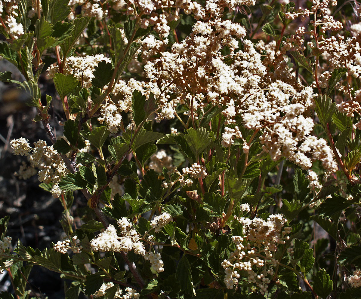
Holodiscus discolor var. glabrescens California—Great Basin Desert. Mono Co., Humboldt-Toiyabe NF: Sweetwater Mts., south of Bridgeport, along Hwy 395, near Murphy Pond; 38º20'30.9", 119º19'24"6, 2210 m. Ghost pine-sagebrush on south facing slopes. 28 Aug 2008
|
|
Idaho. Clearwater NF, Giant White Pine Campground along Hwy 6,. Grand fir, subalpine fir, western white pine, bordering wetland area of Veratrum californicum var. caudatum, Dryopteris, Frangula purshiana, Alnus. 6 Aug 2009. |
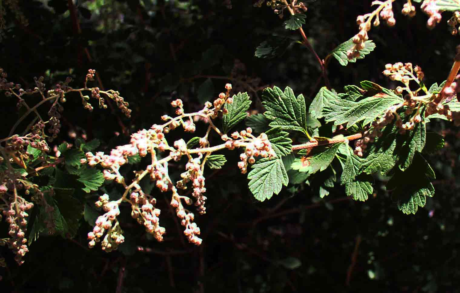
Holodiscus discolor var. discolor Idaho. Clearwater NF, Giant White Pine Campground along Hwy 6,. Grand fir, subalpine fir, western white pine, bordering wetland area of Veratrum californicum var. caudatum, Dryopteris, Frangula purshiana, Alnus. 6 Aug 2009.
|
|
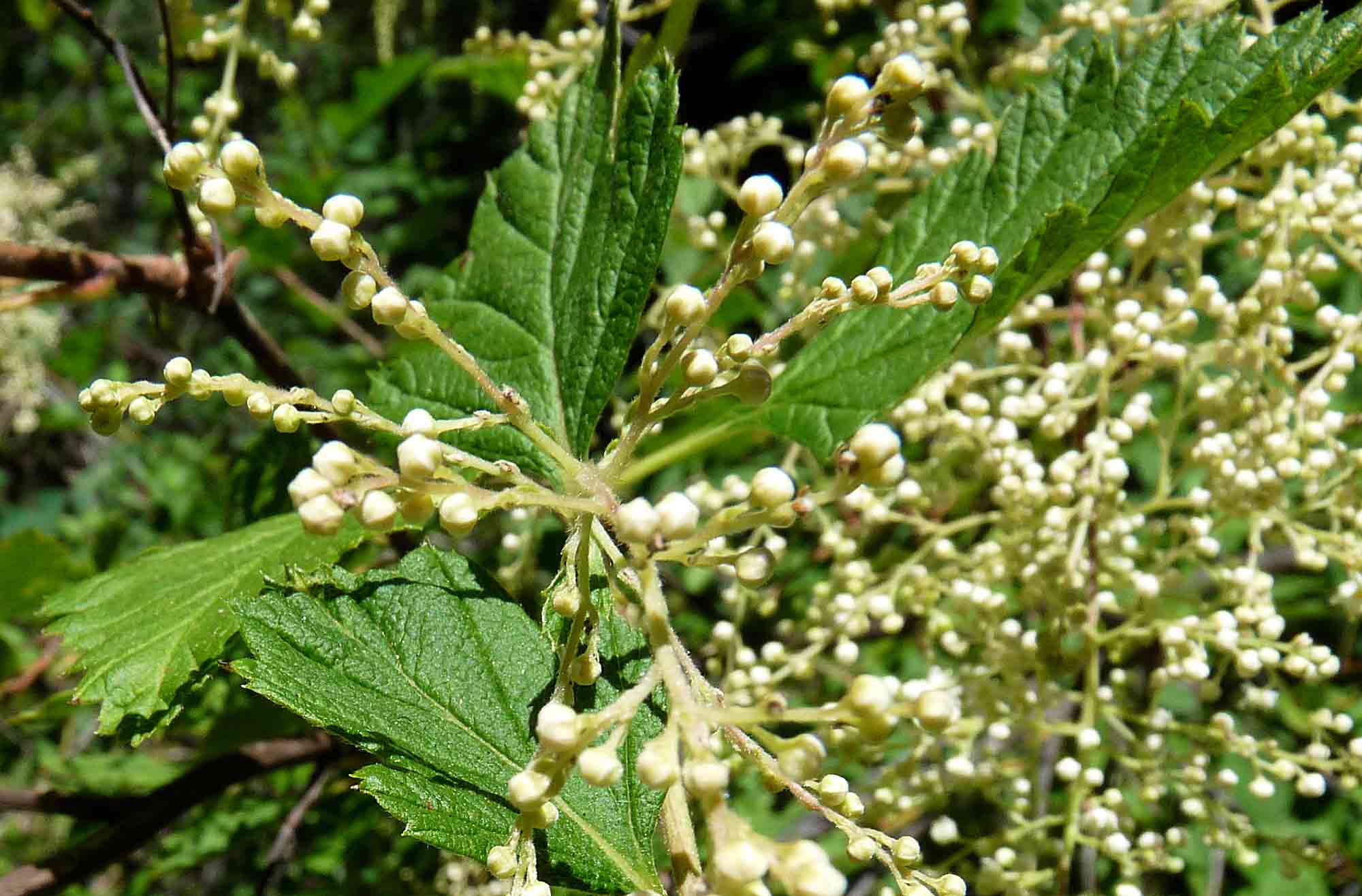
Holodiscus discolor Nevada. Toiyabe Range. South of Austin along Robinson Creek road (4x4 road) to Birch Creek Ranch, which is at junction with Road 376, ~3.5 mi south of Frontier, Hwy 50. 10 July 2009.
|
|
|
Holodiscus discolor var. discolor
Idaho.
Clearwater Co. & NF: Round Meadows
west of Clearwater Creek along FR 1445 and 1445BB ~8 road miles S of Hwy
8 from near Kameron; 46º44.187, 116º15.009", 2950 ft. Grass-sedge-herb
meadows with Veratrum californicum var. caudatum.
Surrounding forest of western red cedar, grand fir and Douglas fir
with Holodiscus
common at the margin.
|
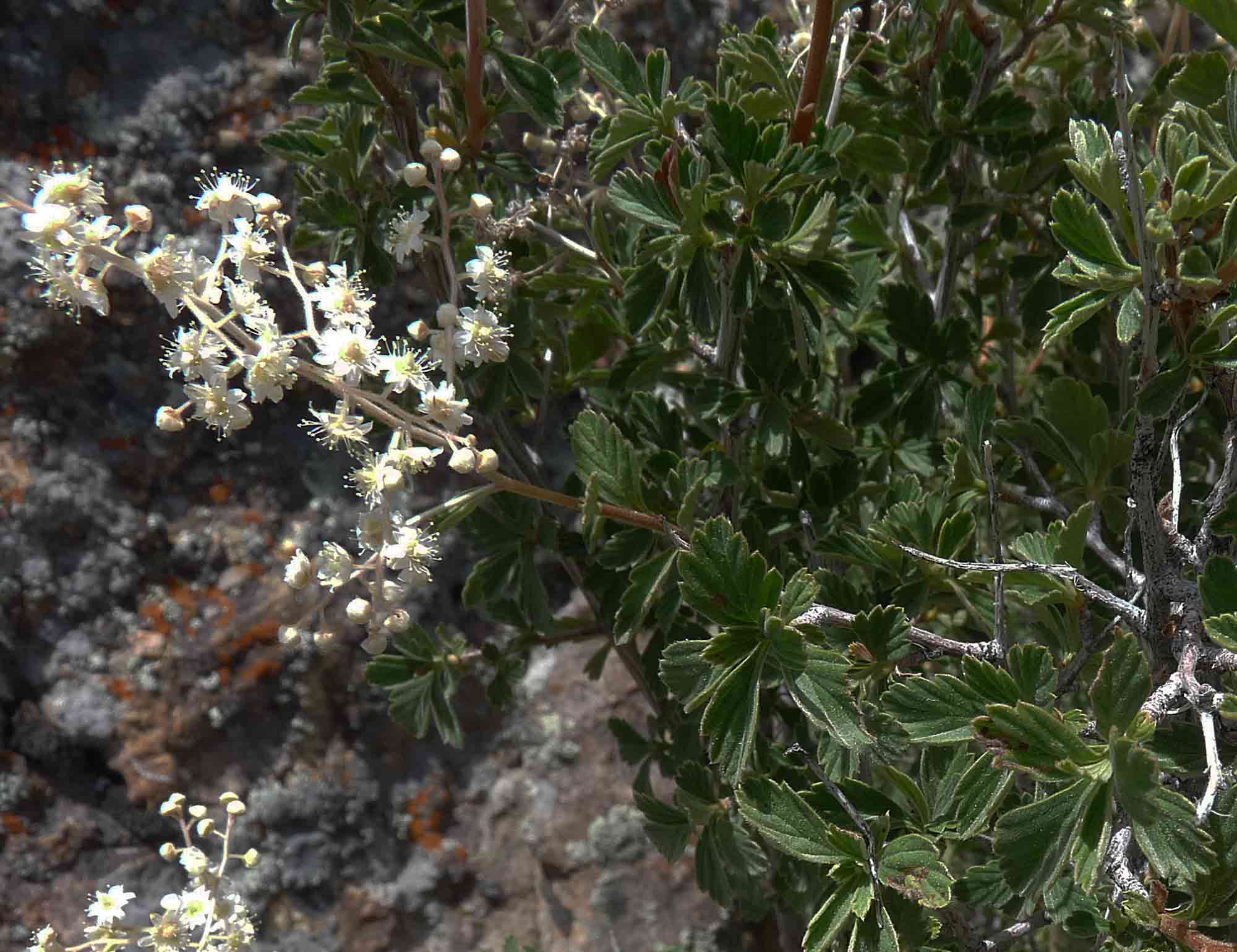
Holodiscus discolor var. microphyllus California—Great Basin Desert. Mono Co., Humboldt-Toiyabe NF: Sweetwater Mts., south of Bridgeport, along Hwy 395, near Murphy Pond; 38º20'30.9", 119º19'24"6, 2210 m. Ghost pine-sagebrush on south facing slopes. 28 Aug 2008
|
|
Trees and Shrubs of Kern County (Dec 2012) Holodiscus discolor (Spiraea discolor Pursh 1814) Maximowicz 1879 var. microphyllus (Holodiscus microphyllus Rydberg 1904) Jepson 1936 [Holodiscus boursieri (Spiraea boursieri Carrière 1859) Rehder 1915]. Cream bush, ocean-spray. Low densely and finely branched shrub to 1 m: stems with fibrous, shredding bark, twigs reddish, ribbed or striate, with whitish soft fine hairs; leaves deciduous, small, wedge-shaped, ~2× longer than wider, <3 cm, narrowed to base from above mid region, shallowly toothed above middle, with conspicuous lateral impressed veins extending into teeth and its short bristle; flowers during summer, on short much-branched scapes 2–8 cm, these numerous above the foliage, white; fruit an achenetum of usually 5 achenes (multiple one-seeded indehiscent fruitlets that develop in one flower). Rock outcrops above 3,600 ft, usually in the drier montane conifer forest, from California to Oregon, to Wyoming and south to Arizona and Baja California. Type from Salt Lake Co., UT. Ocean spray brush recognized in MCV2 when >50% relative cover in the shrub layer. Kern Co.: Owens Peak, Pacific Crest trail between Owens Peak and Mt. Jenkins; Sorrel Peak, Emerald Mt, 7000 ft; Scodie Mts., Kiavah Wilderness, Horse Canyon/Cane Canyon saddle, along Pacific Crest Trail; Long Canyon, common, granitic rocks, Heald Peak summit area (Keeler-Wolf 1990); and Cow Creek in the Greenhorn Range; 1,615–2,529 m (CCH). |
|